Showing posts with label Red Rock. Show all posts

July 13, 2011

Bridge Mountain 06.01.2011

Bridge Mountain. It is called so because this bridge is located nearly top of the summit. The peak elevation is 6940 feet, about 7 miles round trip hike. This was listed as class 4/5, difficulty 4/5. This was a bit challenging for me because this hike was listed as one of the difficult ones in my hiking group.  Well I did it though!

Getting to the trail head, you MUST have 4-wheel drive, high clearance vehicle! We drove almost 45min to 1hr on rocky road, REALLY ROCKY road. At some point I swear we were all tilted, thinking the car was gonna tip over. The trail is pretty visible, easy to walk on, and that goes on for a couple of hours. I see the summit on the other side of the valley!


Once through with the easy user-trail part, there is an observation point to where the edge is straight down to the valley down below. Just being careful on our footing by the edge, we had a snap shot together with my good fellow hiker, Steven!

The Bridge Mountain is the other side of the observation point. We descend a bit, walking across the lower sandstone mountain top that leads us to the bottom of the Bridge Mountain. There is no visible trail you can see since it's just wide open space in this area, but you will find some carens that you can follow. In this area, any direction will get us to the foot of the Mountain. It's just right in front of you.
Then, here comes the class 3 climbing. Using hands, basically climbing on one surface of the steep wall of the mountain to gain more elevation.
Believe it or not, descending is harder than ascending. Going down on the same route, you will have some torn pants because there are spots where you have to slide down on your butt!!

The Bridge shows up in front of you once you get done with the climbing with hands. I had never known that such beautiful bridge exists so high up in the mountain. It looks as if it is made of bricks because of the stone texture and its pattern. Very neat. 
The bridge is not the end of this hiking. We passed it going further up to the summit of the Bridge Mountain. Less steeper, but still using hands..  
 On the way up we hiked by the green oasis in the middle of the sandstone.

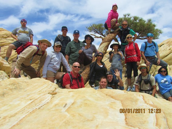
Snap shots with everyone at the top!
The green pool on the summit was interesting too!


June 8, 2011

White Pinnacle Peak 05.24.2011

This is BY FAR, the most challenging hike I've ever done!! Danger 5/5 and class 4/5. I just didn't have a clue how scary "danger 5/5" was going to be.


The trailhead is located OUTSIDE of Redrock loop, we parked the car at Oakcreek parking space on the side of the road. From the trailhead to the foot of the canyon, was a long dawnting task. Just have to go through flat land filled with desert shrubs. No shade so it's the best to start early morning. One time I walked through this area to do the different hike and it was hot afternoon during the summer. It killed me!

Starting
Foot of the canyon
REAL hike starts!

The foot of the Pinnacle Peak is full of boulders. Where we went up was a crack in between two mountains. What you call this, canyon, right?  This canyon consists of large boulders, straight-up-walls with ropes to climb on, steep inclines with loose dirt, and lots of branches and trees to manouver around. This canyon is so narrow that you have to be in a single pile if you are with group. Just enough space for one person to get by all the way to the top.


Need a rope to climb


Hop Step Jump using this boulder
Thats' right. Stone walls are exposed!
In the canyon, it requires a lot of physical strength, especially upper body. You need to be able to pull yourself up on the rock or with rope. Many walls are pretty vertical and exposed though there are lots of tiny cracks and dents where you can place your hands and feet. Finding good hand grips on these rocks are SO crucial. You rely on the grip while you are lifting yourself up. Me having short legs are in a way, disadvantages sometimes. :'(


View from narrow canyon we were in

At this point, we were about 5,500 ft above ground. To the peak on this part is knife edged. We basically have to crawl to get to the top. And the top is really pointy, not having enough room for everyone to sit down in circle and have lunch.

Going back down was, at some points, tougher than going up. When going down the almost-vertical walls, it is hard to see where the foot can go. Searching around the perfect grip on rocks and good foot holes are the key factor for the safety. Always good to hike with someone else so that you will have a spotter at parts like this. One wrong move can make you go BYE BYE from this world! So be careful!

It took us about 5 hours for the whole trip today. The sun was going down by the time we got out of the canyon. Here is the last snap shot of the White Pinnacle Peak hike :)

May 10, 2011

North Peak via the north peak wash 05.03.2011

Let me tell you this. GETTING to the trail head was the worst experience for me!!! The hike is inside the redrock loop, passing the lost creek and picnic area. The dirt road will have a turnoff to the right to La Madre Springs, but we keep going straight. The road gets narrower and bumpier! Here, HC (high clearance vehicle) is required and definitely 4x4 if we had to keep driving to where we did! We were driving 4x4 dodge truck. This truck is TOO BIG for this road! Anyways, I was scared to death as if the car was gonna tip over or something. 

It took us about 45min from the entrance of Redrock to the North Peak trail head. 

This is a hike to North Peak by climbing wash in the back of the mountain. When you say "wash" you think of big boulders laying around and hike up by maneuvering them. Well yeah, we started off doing that, but at one point, that was over. And after that it seemed that we were climbing on one big rock straight up for like 1 1/2 hour. STRAIGHT UP! The hiking description said that this peak is the 2nd highest in Redrock and that we would gain 1300 ft in less than 1100 yard!
The steepness goes on for a while
view as we climb the wash

Just climb climb climb. I was on hands and knees on most parts that I felt as if I were a spider. Good hiking shoes required! Good grip of the hiking boots helped me without slipping.

The view from the top was stunning. I had never seen the view from this side of the park. This peak being the 2nd highest sure makes it a great scenery.
Not a single cloud!
Hi Cheeze!
On the way back, we took a different trail down. And we found this interesting picnic site. Obviously someone? or group of people? have built this.  It is well built by the way.
This is a flat top of the mountain. Whoever built this, found the good spot! We walked around the area to check it out before further descending. Don't wanna be playing or getting too close to the edge because..

This is how it looks below the edge line. I had to extend my short arm to take this picture. Scaarry~
Descending on loose rocks was certainly tough part. It puts so much strain on knees and feet. I can see why people with bad knees really have hard time descending when no problem ascending.
All in all, it was very fitness hike.  Definite alternate to gym day.

April 27, 2011

Calico Tank Peak 04.20.2011

Calico Tank Peak. It is located before going into the visitor center entrance of Red Rock Canyon. This is the very first hiking with Meetup that includes some SCRAMBLING AND EXPOSURE that we had never experienced before! On this day, my husband and I also joined the hiking club called "52 Peak Club". It is a club to achieve all 52 peaks in Las Vegas, mainly located around at Red Rock, Lake Mead and Mt. Charleston. There are some very competitive hikers among the group. And I am so excited to get to hike with them. Anyways, this hike was about 4 hours round trip, requires class 3 scrambling.

Starting at the foot of the peak, already the ground is not flat
Gets steeper, good shoes are really important
Within 1/2 hour, we were already on the bare wall of the mountain. The incline is steep that good hiking shoes with solid grip really come in handy. On this particular wall of mountain, we still did not need to use hands much. Our body keeps the balance against the steep footing.

Already good view from mid point to the peak
 Every once in a while, after steep scrambling, we got to the flatter ground and took break. Then off to more scrambling on vertical wall and edge of the mountain....

Just have to hold on to tiny edges where shoe can fit in...

Trying to find every little crevasses...

Nice pic! We look like rock climber without rope! Wow!
 I had this cheap winter gloves I got from Target. It doesn't work for this kind of hiking! My hands were slipping and couldn't get good grip. So I took them off. The bare hands seemed to work better. But I need to invest on hiking gloves. Even some type of gardening gloves can give you good grips, so I was told. So I'm gonna have to check it out in the store one of these days. My husband seemed to be nervous for me. He always thinks I am clumsy. He knows that I can't be clumsy on the edge of the mountain. No mistake allowed. Because of that reason, he looks nervous when we do this kind of hike (the kind with potential danger). I don't blame him. He loves me!

Anyhow, we are almost to the top. Do you see the red rock changes to the white rock at the top? That's the peak!


almost there.....
 Wah Laahh~!! The PEAK! The feeling of accomplishment is greater this time because of the facts that this was a challenging hike for both of us and that we kept up with some experienced hikers! The advantage I have is that I don't weigh much so it was easier to use my upper body strength to life myself up. My disadvantage is that I have shorter legs which can make thing tougher on some parts of the trail, jumping on big gaps and/or taking big steps on the vertical wall.
All in all, with the help of others, We did it!!

from the left, my hub, me, Marisa,Ted, Gary, Skip, Jack, Patrick and Mj!
 This hike gave us more confidence in our skills on hiking experiences!!


Blog Template by YummyLolly.com - Header made with PS brushes by gvalkyrie.deviantart.com
Sponsored by Free Web Space